
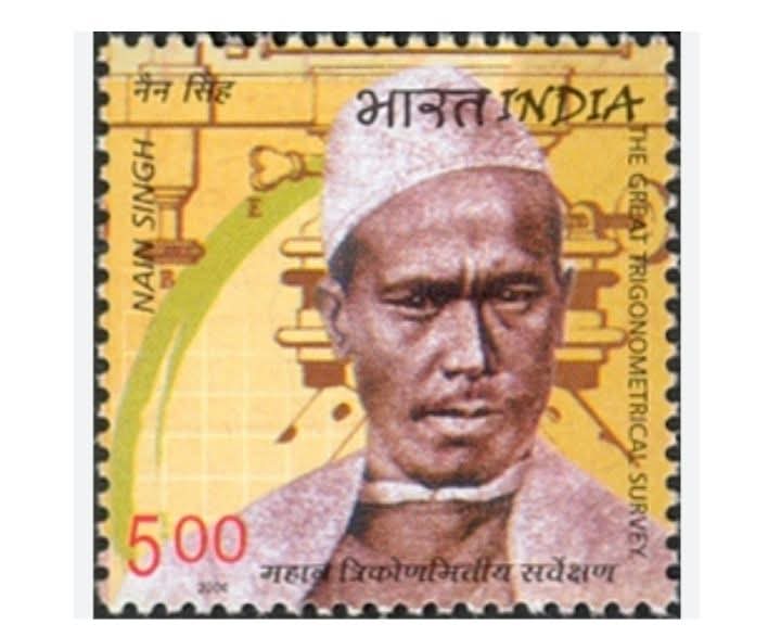
Whose birthday today is 21st October 1830
पिथौरागढ़ के मिलम गांव से निकलकर, 19वीं सदी में उन्होंने तिब्बत और एशिया का नक्शा पैदल ही तैयार किया।
He showed the world the Brahmaputra, the sources of Sutlej-Indus and the heights of Lhasa.
🏅 Honors: Gold Medal of the Royal Geographical Society, gold-encrusted watch from Paris, property of the British Government.
💡 Message: Even with limited resources, the impossible can be made possible with courage, patience and knowledge.
Uttarakhand #PanditNainSingrawat #Inspiration #Explorer #TibetMapping
Pandit Nain Singh Rawat was born on 21 October 1830 in Milam village, Munsiyari tehsil of Pithoragarh district of Uttarakhand. People knew his father Amar Singh as ‘Lata Budha’. He received his primary education in the village itself but due to financial constraints he soon joined his father in the traditional trade between India and Tibet. This gave him the opportunity to visit and understand many places in Tibet with his father. He learned Tibetan language which helped him a lot in future. Apart from Hindi and Tibetan, he also had good knowledge of Persian and English. This great explorer, surveyor and cartographer had also prepared diaries of his travels. He spent most of his life exploring and preparing maps.
Pandit Nain Singh and his brothers joined the GST (Great Trigonometrical Survey) in 1863 and they, especially Nain Singh, continued exploring Tibet until 1875. Nain Singh and his brother Mani Singh were selected by Captain Thomas George Montgomery on the recommendation of the then Education Officer Edmund Smith to explore Central Asia under the GST. His salary was Rs 20 per month. Both these brothers were also trained for two years in the Dehradun office of the Great Trigonometrical Survey.
Pandit Nain Singh prepared a map from Kathmandu to Lhasa and Mansarovar Lake. After this he went to the sources of Sutlej and Sindh rivers. He took part in Douglas Forsyth’s first Yarkand or Kashgar mission in 1870 and later in a similar mission in 1873.
Meanwhile, by the time the mission reached Leh in the summer of 1874, Captain Montgomery had been replaced by Captain Henry Trotter. On the instructions of GTS Superintendent General James Walker, Captain Trotter entrusted Pandit Nain Singh with the responsibility of preparing a map of the northern part of Tibet from Leh to Lhasa. His most difficult journey started from Leh on 15 July 1874, which also proved to be his last exploration journey. In this, he reached Lhasa via Leh in Ladakh and then Tawang in Assam. During this journey he collected many important information which later proved to be very useful. He had to go from Lhasa to Beijing but as this was not possible, he was instructed to come to India via Tsangpo i.e. Brahmaputra or Bhutan.
Pandit Nain Singh had reached Tawang on 24th December but there he was taken prisoner considering him to be a businessman and remained in the custody of the local people till 17th February. Ultimately he was released. He reached Udayagiri on March 1, 1875 and met the local assistant commander who telegraphed Captain Trotter informing him of his safe return. It was the Assistant Commander who arranged for his passage to Guwahati where he met Tsangpo who had now become a Brahmaputra. He went to Kolkata from Guwahati. In this way the Pandit traveled 1405 miles from Leh to Udayagiri. An article on his work was first published in 1876 in The Geographical Magazine.
Pandit Nain Singh also received many award medals in the country and abroad for his amazing work. The Royal Geographical Society honored him with a gold medal. While presenting him the gold medal, Colonel Yule had said that his contribution in preparing the map of Asia is more paramount than that of any other living person. The Society of Geographers of Paris presented him with a gold-studded watch. He was given a village in Rohilkhand as Jagir along with Rs 1000. Many books have been published on his travels. Among these, Derek Waller’s ‘The Pundits’ and Shekhar Pathak and Uma Bhatt’s ‘Asia Ki Peeth Par’ are important. This great inventor died of a heart attack on 1 February 1895.
He was a teacher from a border village in Uttarakhand who not only measured Tibet on foot in the 19th century but also prepared a map of it. This was the period when Tibet was hidden from the eyes of the world and was called Forbidden Land. Foreigners were completely prohibited from coming there. Pandit Nain Singh not only went to Tibet but also made a map of Tibet and that too without any modern equipment.
In the 19th century, the British were preparing the map of India and had made a map of almost the entire India. Now they were preparing to move ahead but the biggest obstacle in their progress was Tibet.
This area was hidden from the world. Not only was there very little information about it, but foreigners were also strictly prohibited from going there. In such a situation, the British were in a dilemma as to how the map there would be prepared?
Although the British government made many attempts, it failed every time. Retired IAS officer SS Pangati, who has written a book on Pandit Nain Singh and is doing research on him, says that the British officers had failed to know Tibet.
After failing several times, the then Surveyor General Mount Gummery decided that instead of the British, Indians should be sent there who often come there to trade with Tibet.
And then the search began for people who could collect geographical information about that place. And finally in 1863 Captain Montgomery found two such people. 33 year old Pandit Nain Singh and his cousin Mani Singh.
Now the biggest challenge was how to take the instruments for measuring direction and distance to Tibet because they were very large in size and if caught, the Tibetans could consider them as spies and give them the death penaltyEventually both the brothers were brought to Dehardun for training and it was decided that they would take a small compass to measure direction and a thermometer to measure temperature. There was a prayer wheel in the hand which Tibetan monks carry and a unique method was adopted to measure the distance. A 33.5 inch rope was tied to Nain Singh’s feet so that his steps fell only to a certain distance. With this, he was made to practice for months in Dehradun. Instead of the Hindu kanthi of 108, the rosary he held in his hands was of 100 beads so that counting could be easier.
Even though the equipment they had was very simple, their courage was extraordinary. In 1863, both the brothers went their separate ways. Nain Singh Rawat left for Tibet via Kathmandu and Mani Singh via Kashmir.
Mani Singh failed in this very first attempt and returned from Kashmir but Nain Singh continued his journey. He reached Tibet and hid his identity and lived as a Buddhist monk.
He would stroll in the city during the day and count the stars from a high place at night. Whatever calculations he used to do, he would remember them in the form of poems or write them on paper and hide them in his prayer wheel.
Nain Singh Rawat was the first to tell the world what is the height of Lhasa above sea level, what is its latitude and longitude. Not only this, he traveled about 800 kilometers on foot along the Brahmaputra river and told the world that Swang Po and Brahmaputra are the same river.
Firstly, the sources of Sutlej and Indus rivers and Brahmaputra are the same river.
He was the first to tell the world the sources of Sutlej and Indus rivers. For the first time, he introduced the world to many unseen and unsolved mysteries of Tibet.
The most important thing is that with his wisdom, courage and his scientific efficiency, he made the map of Tibet by risking his life.
Pangati, who has written a book named Saga of Native Explorer on Nain Singh, tells how difficult it was. Being an explorer, Nain Singh Rawat made four big journeys.
First of all, in the year 1865, he went to Lhasa via Kathmandu and returned to India in 1866 via Kailash Mansarovar.
In the year 1867-68, he went to Thok Jalung in Tibet via Mana Pass in Chamoli district in Uttarakhand, where there were gold mines.
His third major journey was from Shimla to Leh and Yarkand which he did in the year 1873-74.
His last and most important journey was in the year 1874-75. He went from Ladakh to Lhasa and then reached Assam from there. In this journey, he passed through such areas where no man in the world had yet reached.
Nain Singh is not only remembered as an explorer but he was the first Indian to write a book on modern science in Hindi named Akshansh Darpan. These books are also like a treatise for the coming generations of surveyors.
His works were greatly appreciated during the British Raj. In 1977, the British Government gave him the Jagirdari of 3 villages near Bareilly as a reward. Apart from this, considering his works, he was given the title of Companion of the Indian Empire. Apart from this, many organizations also appreciated his work. His contribution in preparing the map of Asia is paramount.
The Royal Geographical Society honored him with a gold medal.
The Indian Postal Department issued a postage stamp on him on 27 June 2004, 139 years after his achievement